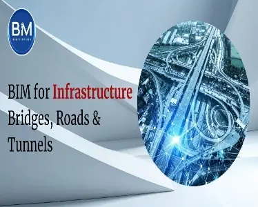
How civil construction teams use BIM to design smarter, build faster, and hand over with confidence.
Civil projects are complex ecosystems-multiple corridors, utilities, disciplines, permits, and a lot of moving parts. Building Information Modeling (BIM) gives you a single source of truth from planning to O&M. In this guide, we’ll break down how BIM for infrastructure works on bridges, roads/highways, and tunnels, with practical workflows, deliverables, and a field-tested rollout plan.
Why BIM matters in civil construction
BIM isn’t just “3D pretty pictures.” It’s a data-rich model that ties geometry to time, cost, quantities, and asset data. For civil teams, that means:
- Fewer redesign loops and RFIs thanks to early
- Reliable quantities for estimates and procurement
- Safer work zones and staged construction sequencing
- Clear, searchable as-builts for operations and maintenance
Further reading for civil teams: A quick primer on why civil engineers benefit from BIM.
Core BIM building blocks (applies across bridges, roads, tunnels)
Model scope & LOD
- Define what’s modeled and at what Level of Development (LOD) by phase (concept → detailed design → construction → handover).
- Civil elements typically include terrain, corridors, alignments, structures, drainage, utilities, traffic/ITS, signing, barriers, and staging.
- Lock a shared parameter schema for naming, codes, and asset IDs from Day 1.
Deep dive on LOD basics and why it matters.
4D & 5D (time & cost)
- Link schedule (Primavera/MSP) to model for staging, closures, detours, and work zone safety reviews.
- Push quantities from the model for estimates, procurement packages, and earned-value tracking.
Reality capture → Scan/Point Cloud to BIM
- Laser scans and LiDAR give ground-truth existing conditions: piers, abutments, retaining walls, utilities, pavement, and bore profiles.
- Converting point clouds to BIM de-risks design tie-ins and phasing.
BIM for Bridges
What to model
- Superstructure: girders/box sections, deck, diaphragms, post-tensioning ducts, bearings, joints.
- Substructure: abutments, piers/columns, caps, foundations (piles/shafts/footings).
- Ancillaries: barriers, drainage, utilities, lighting, conduit, ITS, signage.
Key workflows
- Parametric geometry for girder libraries, tendon profiles, rebar sets, and bearing families.
- Analytical links to structural software for load paths and deflection checks.
- Clash coordination (e.g., PT ducts vs. rebar, utilities vs. diaphragms) with disciplined issue tracking.
- 4D sequencing for staged deck pours, traffic shifts, and falsework/temporary works.
Deliverables
- Coordinated 3D model + 2D shop/fabrication drawings.
- Quantity takeoffs (concrete volumes, rebar tonnage, bearings, anchor rods).
- Method-of-construction simulations for stakeholder reviews and road authority approvals.
Wins to expect
- Fewer site changes at bearings/joints.
- Cleaner fabrication and fewer RFIs on rebar/PT.
- Safer staging via validated pour and traffic phases.
BIM for Roads & Highways
What to model
- Alignments & corridors (horizontal/vertical geometry, typical sections, daylighting).
- Pavement: layers, medians, shoulders, sidewalks, and curb/gutter.
- Drainage: inlets, manholes, culverts, ditches, swales, detention.
- Utilities: wet/dry relocations, jointing, crossings, and depth clearances.
- Traffic & safety: barriers, guardrails, signage, lighting, ITS cabinets, pull boxes.
Key workflows
- Civil corridor modeling to drive accurate cross-sections and quantities by station range.
- Visibility & sight distance: checks using the model geometry.
- Work-zone BIM: detours, MOT devices, temporary barriers, and staging in 4D.
- Cost-loaded 5D: for pay items by station, layer, and material.
Deliverables
- Plan/profile/cross-sections generated from the model (no double work).
- Material takeoffs (aggregates, asphalt, concrete, pipe runs).
- MOT phasing animations for public meetings and agency sign-off.
Wins to expect
- Early clash detection (utilities vs. drainage vs. structures).
- Reduced asphalt overrun via geometry-driven quantities.
- Faster buy-in at public hearings with clear visuals.
BIM for Tunnels
What to model
- Excavation envelopes, primary/secondary lining, waterproofing, and segment rings.
- Portals, adits, cross-passages, ventilation ducts, sump pits.
- MEP/ITS: lighting, cable trays, jet fans, hydrants, emergency phones, SCADA.
Key workflows
- Geotechnical context embedded in the model (strata, groundwater, settlement allowances).
- Segmental design libraries with parameterized gasket grooves, keyways, and rebar.
- MEP coordination in constrained envelopes-run clash rulesets tight (tolerances matter).
- Construction simulation: TBM advance, mucking, ring-build sequences, and shutdown windows.
Deliverables
- Multidisciplinary 3D with tunnel systems + coordinated MEP.
- 4D sequence of excavation/lining and installation windows.
- Commissioning data for life-safety testing and digital handover.
Wins to expect
- Cleaner penetration management and fewer late reroutes.
- Better life-safety readiness via model-driven testing plans.
- Maintainable assets with tagged equipment and O&M data.
Coordination playbook (what separates good from great)
- Information Requirements: Publish an Exchange Information Requirements (EIR) / BEP with model breakdown structure, coding, file naming, and approvals.
- Discipline gates: Architecture/structures/utilities/drainage sign-offs at each milestone; keep a “no-late-surprises” cadence.
- Rules-based clash: Tolerance matrices by system (e.g., min cover to utilities, clearances to parapets, duct banks).
- Field feedback loop: Redline in the field → update the model weekly → auto-refresh dashboards.
- Digital QA/QC: Model checks for levels, slopes, superelevation, minimum radii, headroom, and ADA details.
- Reality capture: Scan critical tie-ins and as-builts; reconcile deviations and update the federated model.
A primer on Scan/Point-Cloud to BIM and why it’s vital for existing conditions.
What owners and contractors get (by phase)
Planning
- Rapid options: alternative alignments, bridge types, tunnel profiles.
- Early quantity bands and ROM costs for decisions.
Design
- Integrated corridor + structures + drainage + utilities in one federated model.
- Constructability workshops directly in the model.
Construction
- 4D look-aheads, clash-free staging, and cost-loaded progress ties.
- Field-friendly model views on tablets; punch/issue logs tied to model elements.
Key BIM value themes for cost/time/safety.
Handover & O&M
- Asset registers (IDs, warranties, spares) baked into the model.
- Searchable, visual as-builts for inspections, repairs, and future widening.
Implementation checklist (use this to launch or level-up)
- Set the target: pick 3–5 measurable BIM outcomes (e.g., ±2% quantity variance on asphalt; zero utility surprises; 100% staged MOT in 4D).
- Lock standards early: file naming, parameters, LOD/LOI per element, and approval workflow.
- Model only what you need: focus on pay items, risk areas, and handover assets; don’t bloat.
- Own the schedule: integrate the CPM with model elements and rehearse traffic switches in 4D.
- Quantities from the model: tie WBS/pay items to geometry; validate by station/sample.
- Scan smart: capture existing bridges/portals/tie-ins; use point clouds for as-builts at milestones.
- Close the loop: weekly coordination, issue burndown charts, and clear RFI paths.
- Plan the handover: define asset attributes (IDs, spares, O&M) months before substantial completion.
Common pitfalls to avoid
- Treating BIM as “CAD in 3D” without data standards.
- Modeling everything-instead model what drives risk, cost, or handover.
- Skipping tolerance rules; civil envelopes are tight, especially in tunnels.
- Late utility coordination-start with records + scan, then validate.
- Creating beautiful 4D animations no one links to the actual CPM.
Conclusion
Whether you’re delivering a cable-stayed bridge, a congested urban interchange, or a twin-bore tunnel, BIM for infrastructure turns complexity into coordinated, buildable plans-and leaves owners with maintainable digital assets. Start with standards, model what matters, connect schedule and cost, and use reality capture at key milestones. The result: fewer surprises, safer staging, tighter quantities, and O&M-ready handover data.