Introduction
In 2012, Hurricane Sandy ravaged the city of New York with a flood event that New York City wasn’t designed for – a catastrophic storm surge that would influence the approach to designing future coastal defences in the region. Currently, planners are looking at a very ambitious and costly project called the Mega Sea Wall Project, which would cost somewhere between $52 billion to $119 billion. Although the cost of construction may sound very high, the consequences of such an event are much more important than the cost involved in constructing such a project. The key is to design such a project efficiently and effectively. And that’s where the application of new infrastructure technology comes in.
Why New York City Faces Increasing Flood Risks
The geography of New York City is quite disadvantageous concerning water. The majority of the infrastructure of this city was constructed in the 19th and 20th centuries, which are characterized by climate stability and fewer cases of flooding. Currently, however, this infrastructure is exposed to various problems – including rising sea levels, more frequent occurrence of storm surges, and an outdated system for a different climate.
Climate change is the primary factor. The sea level in New York rises faster than the global average because of the thermal expansion due to warming water as well as melting of glaciers on Greenland and Antarctica. Additionally, the storms themselves become more intense. New York is not only prepared for the worst case scenario – it is prepared for what is already occurring.
Hurricane Sandy and the Lessons Learned
On October 29, 2012, Hurricane Sandy made its way to the shores of Atlantic City, New Jersey, at the speed of more than 70 miles per hour. The result was catastrophic, leaving 17 percent of New York City underwater. Millions of residents were left without power, and the cost of the damages was estimated at more than $19 billion.
What was significant about Sandy was the realization that the existing system of defenses was insufficient. Salt water entered Lower Manhattan, the Financial District and parts of Brooklyn, such as Red Hook. Lives and property were lost, and the area took several years to recover from this disaster.
Sandy taught the government that partial measures like pumping mechanisms here or walls there were not sufficient. The town required an overall and long-term solution. This gave rise to discussions on Mega Sea Wall, an ambitious project that was meant to re-think coastal defenses completely.
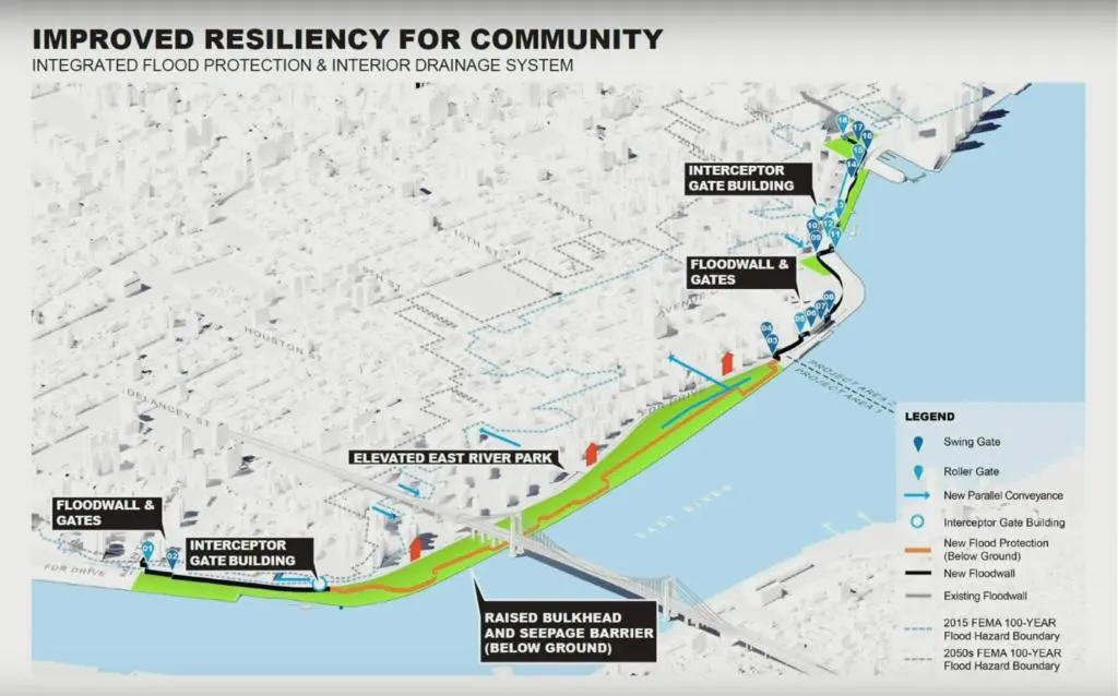
What Is the Mega Sea Wall?
The Mega Sea Wall is not an unbroken wall. Rather, it is a system, which consists of different kinds of barriers, levees, and storm water drainage. Specifically, it includes storm surge barriers that can be used at the harbor’s mouth, as well as permanent barriers for waterfront areas, and an improved drainage system in the city’s interior.
The initial proposal was estimated at about $119 billion, which made the project controversial among politicians and citizens. As a reaction, the city planners have started to look for more economical solutions, with the recent proposals costing $50 to $53 billion. It all depends on what parts of the city would be chosen and what design would be used.
The Mega Wall scheme aims at protecting more than 16 million people in the area of the metropolitan region in New York and New Jersey. This scheme protects one of the biggest economic centers in the world.
Challenges of Building a Project of This Scale
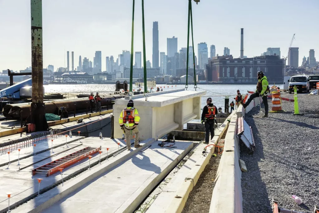
A Mega Sea Wall is not only an engineering task but a logistical and political one as well. This is mainly due to the huge amount of time and effort that the project will require and the large number of people that will be needed for its construction.
Environmental issues matter greatly. How does the construction of these barriers impact tides, aquatic life, and birdlife, as well as the quality of water? Can there be a possibility that the barrier which prevents entry of salty water at the same time traps the stormwater in the enclosed region?
Finally, there is the issue of financing. With such an expensive project as this costing between $50 and $119 billion, it simply would not be possible to finance it using only the funds from the city or the state alone. Federal assistance is required, but even then it is competing against a number of other infrastructure projects in terms of financing.
How Laser Scanning to BIM Supports Infrastructure Planning
It is at this stage that technology makes all the difference. For something as complicated as the Wall, one will require very detailed information on the environment that already exists. This is where Laser Scanning to BIM comes in.
The laser scanning technique records the precise shape of the preexisting building and environment. By means of Light Detection and Ranging (LiDAR), scanners create millions of data points per square meter which are subsequently used to generate precise Building Information Models (BIM).
Laser Scanning to BIM for the Mega Sea Wall offers accurate data on the shoreline assets, existing utility networks, underground utility networks, and terrain. It gives engineers detailed knowledge about where the structure should be built and what buildings will be affected, including how it will work with subway tunnels, water pipes, and sewer systems. The data helps in conflict resolution before any construction takes place.
The Importance of 3D BIM Modelling for Coastal Defense Projects
After capturing Laser Scanning to BIM data, the next process involves 3D BIM Modelling, where designers create detailed digital models of the whole Mega Sea Wall system. It’s not just about drawing something in 3D; it’s about creating an information-rich environment where every element has its characteristics, material type, cost, and maintenance schedule.
What if you could visualize the Wall Construction Project in 3D with different zones that are colored in accordance with different aspects such as the construction phase, materials used, environmental impact, and timeline? This is made possible by using 3D Building Information Modeling (BIM).
Models will allow for collision detection. Before construction begins, teams can identify conflicts between flood barriers and existing utilities, helping keep the coastal resilience project on schedule and within budget.
How Digital Twins Can Improve Future Resilience
The innovation of BIM for the Mega Sea Wall comes in the form of the creation of a digital twin, a real-time model that updates itself in relation to the real physical system.
For the proposed flood protection system, a digital twin would combine 3D BIM Modelling with data collected from sensors installed throughout the infrastructure. The sensors on the wall, gates, and drainage systems provide real-time information regarding water levels, stress, and other relevant data. This will allow for the analysis of the data through algorithms.
This also makes it possible for simulation and testing. The city government could create scenarios: What would happen in case of a Category 4 hurricane? How would flood gates function? Where would the water go when it returns back up? This way, by making use of digital twins, the city government could fine-tune its responses through such simulations before any emergency situation takes place.
Arguments For and Against the Mega Sea Wall
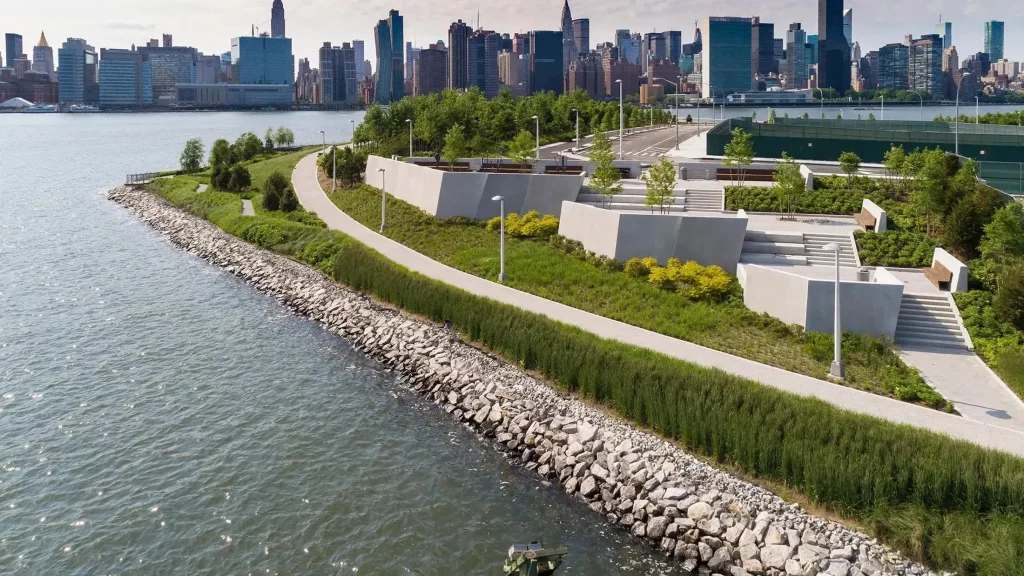
The case is straightforward: it will protect the most vulnerable parts of the city from flooding and help secure the region’s future economic stability; give peace of mind to millions of people. Arguments against the mega structure include cost, environmental consequences, and the idea that some other measures can be implemented, like building structures on high ground.
Some communities wonder about the impact the barrier would have on their communities. Would they lose out on any waterfront parks? Would the barriers keep them away from the waterfronts? Could the Mega Sea Wall become an eyesore to them? This is not an insignificant issue in a city like Boston that places so much value on its waterfront.
The honest truth is that there is no perfect solution. This kind of coastal protection project is ambitious, expensive, and complex. But the cost of inaction—another Sandy or something worse—could be even higher.
Conclusion
The future of New York City seems uncertain. The climate changes, the sea levels increase, and the hurricanes become more violent. However, the Mega Sea Wall is the big bet on the engineering solution to this problem. Whether the cost of the final product will be $50 billion or even $119 billion and whether it will have all the suggested barriers or only some of them, the essence of this idea will not change.
Laser scanning for BIM, 3D BIM modeling, and digital twins technologies are making this challenging project possible. With them, it is easier to get the overview of the whole system, discover potential issues, and implement the solutions virtually before implementing them in reality.
The Mega Sea Wall is more than a wall; it’s a pledge to the future. Millions of people living in the New York–New Jersey area aren’t asking if the city should build it. They’re wondering how to do it right now.
Disclaimer
This article is provided for informational and educational purposes only. The project costs, timelines, and specific design proposals for the Mega Sea Wall are subject to change as government agencies, urban planners, and project stakeholders continue to evaluate and refine options. Some information reflects proposals or concepts under discussion and may not represent final approved plans. Readers seeking the most current and official information about the Sea Wall project should consult official documents from the City of New York, New York State, the U.S. Army Corps of Engineers, and other relevant government agencies. This article should not be considered definitive guidance for decision-making or investment purposes related to the project.